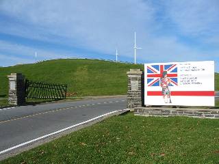
Completed in 1856, the Halifax Citadel overlooks the harbour from the highest downtown point. Officially known as Fort George, the Citadel is a national historic site. While entrance to the Citadel itself has a fee, the hill it sits on and the car route around the Citadel can be enjoyed for free.
Click here for a slideshow of the area.
Trail Maps
Map from Trails Nova Scotia.
Bus Service
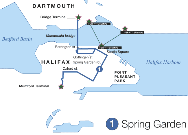
- Route 1
(Map)
(Schedule)
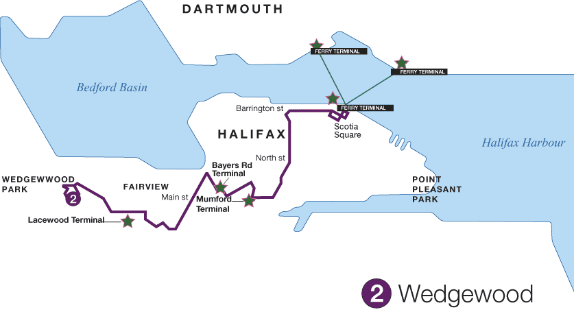
- Route 2
(Map)
(Schedule)
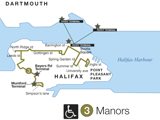
- Route 3
(Map)
(Schedule)
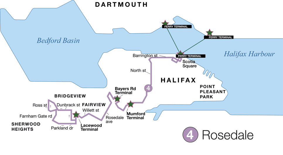
- Route 4
(Map)
(Schedule)
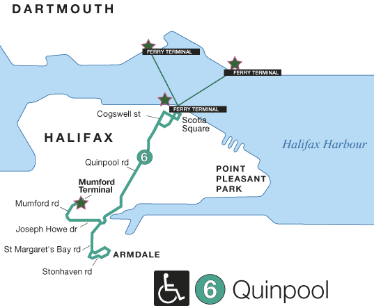
- Route 6
(Map)
(Schedule)
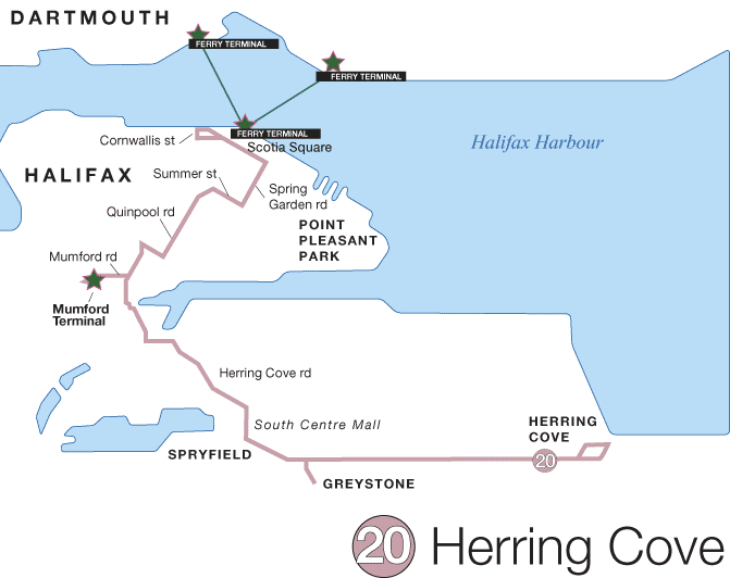
- Route 20
(Map)
(Schedule)
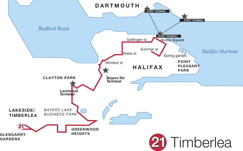
- Route 21
(Map)
(Schedule)
- Route 31
(Map)
(Schedule)
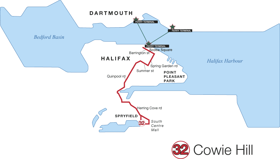
- Route 32
(Map)
(Schedule)
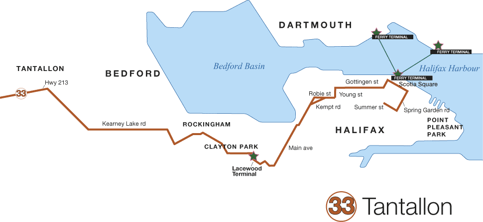
- Route 33
(Map)
(Schedule)
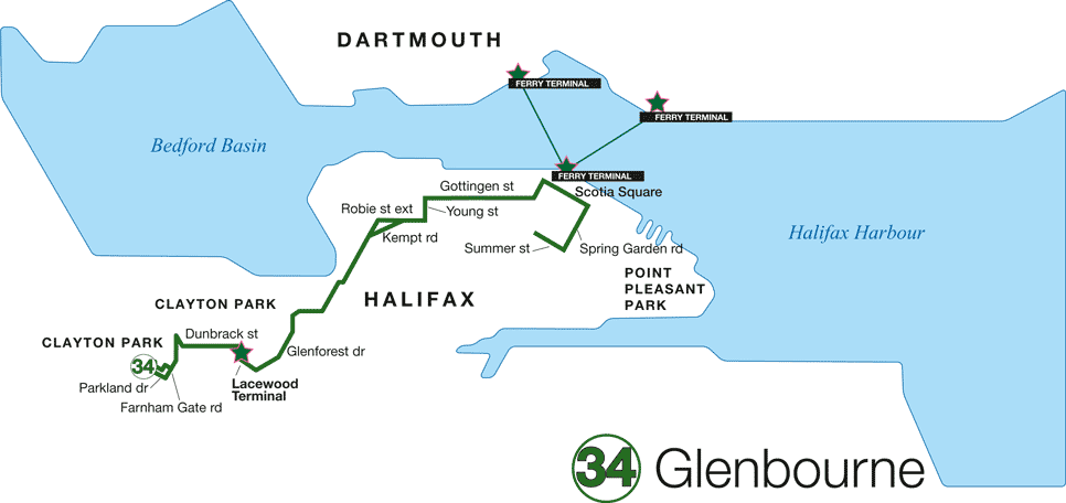
- Route 34
(Map)
(Schedule)
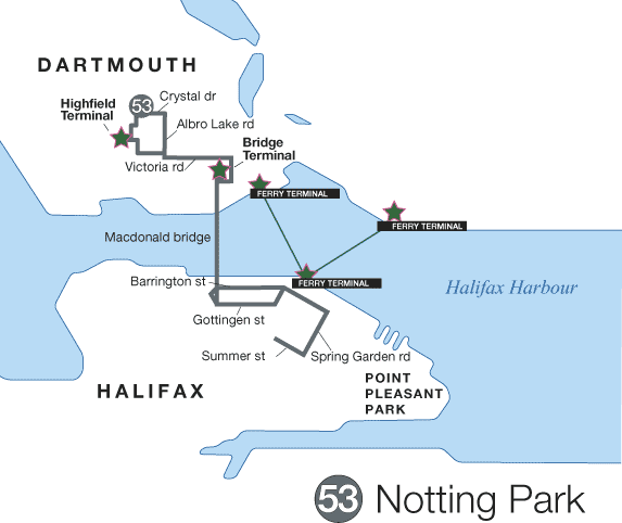
- Route 53
(Map)
(Schedule)
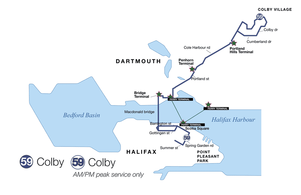
- Route 59
(Map)
(Schedule)
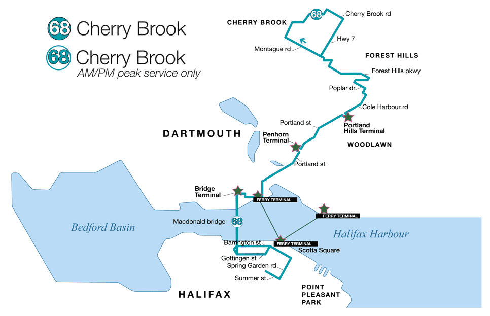
- Route 68
(Map)
(Schedule)
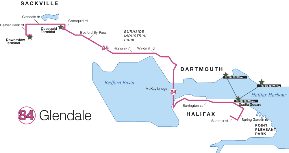
- Route 84
(Map)
(Schedule)
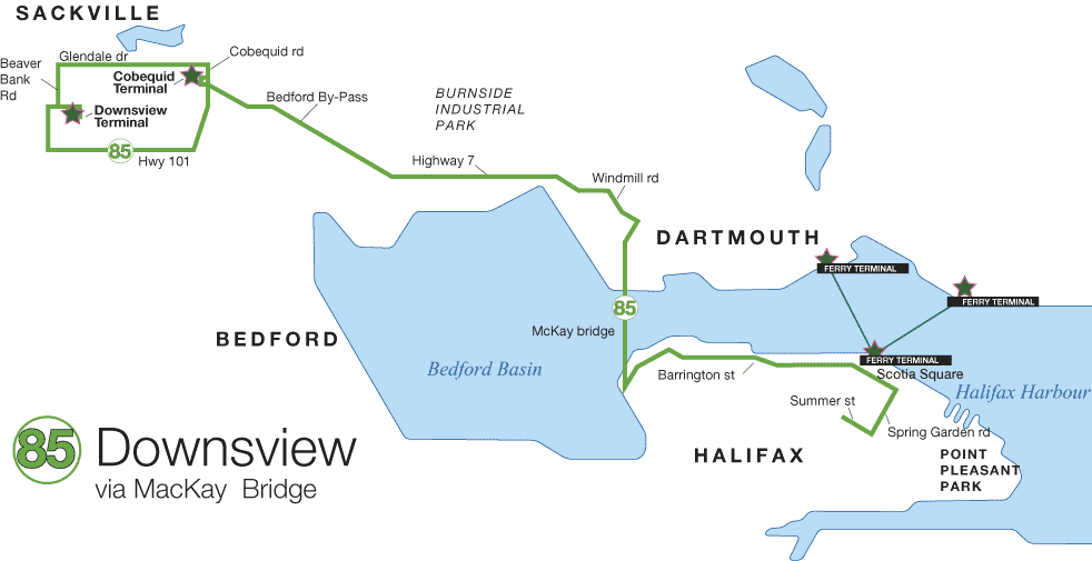
- Route 85
(Map)
(Schedule)
- Route 86
(Map)
(Schedule)
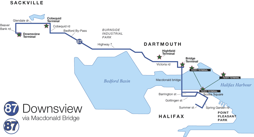
- Route 87
(Map)
(Schedule)
For the entire Halifax-Dartmouth route map click here.
For schedule changes see the Metro Transit website.
Bike Access
On primary bicycle routes with a bike path on Brunswick St.. (Halifax Bike Map)
Hours
No restrictions posted.